El Niño’s end is imminent: What it means for summer weather
(NEXSTAR) – Say goodbye to El Niño. National forecasters announced Thursday that El Niño is expected to end in the next month.
What comes next is a period of neutrality – called “ENSO neutral” – in which neither El Niño nor La Niña is present. But even that isn’t expected to last long. The Climate Prediction Center expects La Niña to develop by mid-to-late summer.
What does all this climate chaos mean for summer weather in the U.S.?
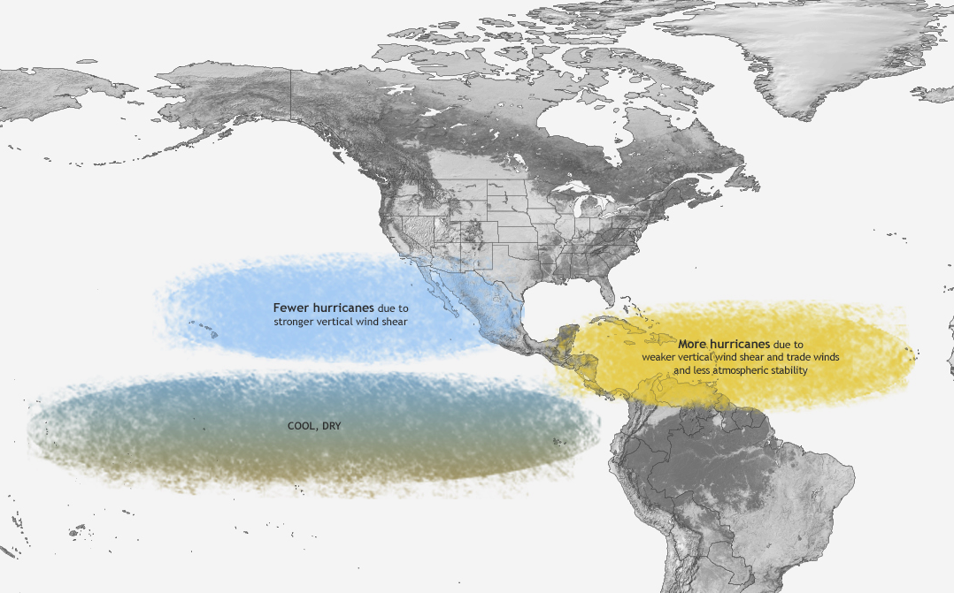
El Niño and La Niña don’t have as big of an impact on summer weather as they typically do in winter, when the climate phenomena typically reach peak strength. But one way La Niña could play a role this summer is by impacting hurricane season.
La Niña years are known to be linked with more, stronger hurricanes in the Atlantic, but fewer in the Pacific. La Niña is currently favored to begin some time between July and September – just in time for peak Atlantic hurricane season.

That forecast is in line with recent predictions of an “extremely active” hurricane season for 2024.
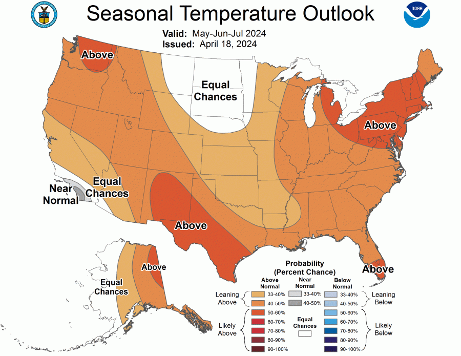
For those outside the hurricane zones, they can probably expect one thing from this summer: heat. All but two states are favored to see above-average temperatures between May and July.

The highest probability of an extra-hot summer season is in the Northeast and parts of the Southwest.
Another impact we might see from the quick transition from El Niño to La Niña will only be visible off the coast. La Niña means colder, more nutrient-dense waters in the Pacific, which attracts more marine lift to the area.
Copyright 2023 Nexstar Media Inc. All rights reserved. This material may not be published, broadcast, rewritten, or redistributed. Regular the hill posts


