(NEXSTAR) – There’s a “greater than 90% chance” the El Niño, which developed unusually early this year, will last through winter in early 2024, National Weather Service forecasters said Thursday.
El Niño is expected to continue strengthening until it reaches its peak sometime in winter. That’s when the climate pattern can have the biggest effects on weather around the country.
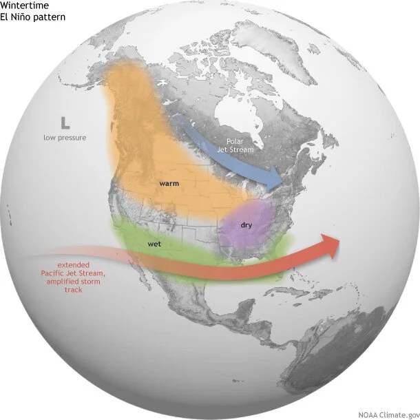
El Niño has different impacts depending on where you live. The southern third to half of the United States, including California, is likely to be wetter this winter. (Exactly where that dividing line falls varies from year to year.)
Meanwhile, the Pacific Northwest and parts of the Ohio Valley tend to be dry and warm.
Hawaii also often sees below-average rain during an El Niño fall, winter, and spring season.
How noticeable the impacts will be this year largely depends on how strong this “young El Niño” grows. On Thursday, the Climate Prediction Center said there’s an 81% chance of “moderate-to-strong intensity.”
A “historically strong” El Niño is possible – but less likely at this point. There’s about a 1 in 5 chance we see an El Niño like the extra-strong winters of 1997-1998 or 2015-2016, forecasters said.
Whether we’re in a La Niña year, El Niño year, or neither is determined by sea surface temperatures near the equator over the Pacific Ocean. The temperature of the water and air above it can shift the position of the jet stream, which in turn impacts the types of weather observed on land.